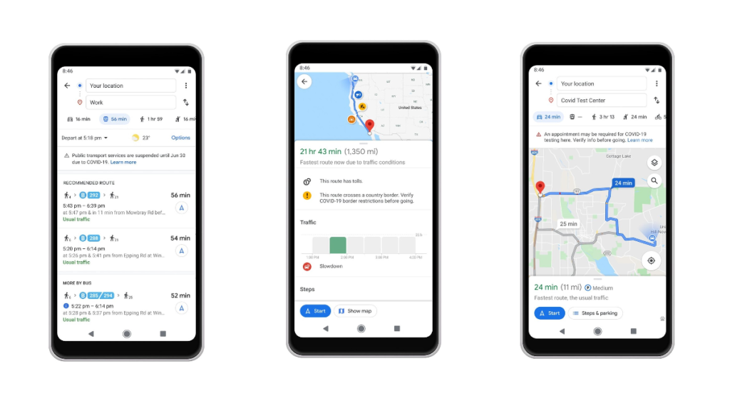
Google Maps adds new COVID-19 alerts feature. Google has rolled out few features to Google Maps which will show relevant alerts of COVID-19 from the local transit agencies according to the recent blog post.
Now Google Maps will show alerts from local transit agencies like take down of public transport due to some restrictions.
Google has also added driving alerts feature in maps to notify the checkpoints and restriction along the route before starting the ride.
While going to COVID-19 testing centres or medical facilities, Google Maps will display an alert to remind to verify the eligibility to avoid turn away.
Safely avoid crowds on public transit
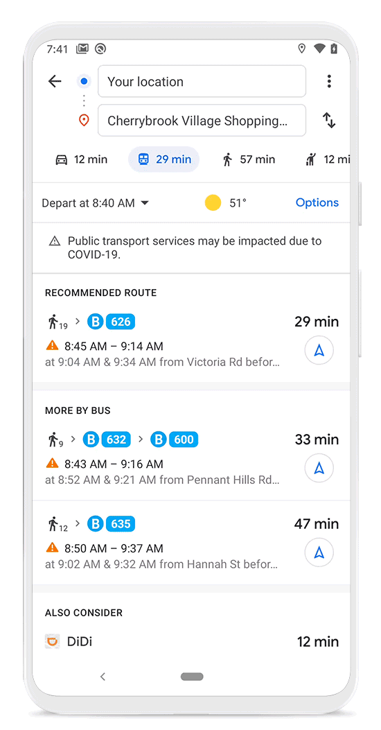
Google has added a new feature which will determine the crowd during the public transit like busses and trains. The data will be collected from local transit users. It will help to determine the crowed on-board specific to a public transit.
Now users can track the busyness data from Google Maps by “simply search for a station or tap on the station to see departure board and busyness data”
As of now, some features are available in some countries, soon it will be expanded. These features are rolled out to both Android and iOS platforms.
For more related content follow us on Twitter, Telegram, Facebook.